Shipping takes place within 3-5 business days. If there is a problem with the shipment of the product, we will notify you via the email address you entered when ordering.
1
/
의
8
NiesahYan
A6 Handheld GPS for Hiking, Multi-GNSS Support, Lightweight Rugged GPS Navigator,Waterproof GPS Handheld for Camping and Backpacking
A6 Handheld GPS for Hiking, Multi-GNSS Support, Lightweight Rugged GPS Navigator,Waterproof GPS Handheld for Camping and Backpacking
정가
$175.00 USD
정가
$175.00 USD
할인가
단가
/
단위
픽업 사용 가능 여부를 로드할 수 없습니다.
About This
- HIGH ACCURACY:Access 4 global navigation satellite systems (GPS+GLONASS+BEIDOU+QZSS) for improved position accuracy, especially in challenging terrain or areas with weak signals, position accuracy<5ft
- SCREEN: 2.4 inch sunlight-readable color display for easy viewing, can see the navigation interface clearly even at night,also equipped with button-operated and non-slip design
- 4 WAYPOINT FUNCTION: Save current GPS coordinates, enter known coordinates, and navigate to the coordinates, delete coordinates,can save 1000 waypoints
- TRACK NAVIGATION: Record your tracks before hiking,it can guide back to your starting position when you lost your direction,and store waypoints along a track,the most reliable partner for your outdoor adventure
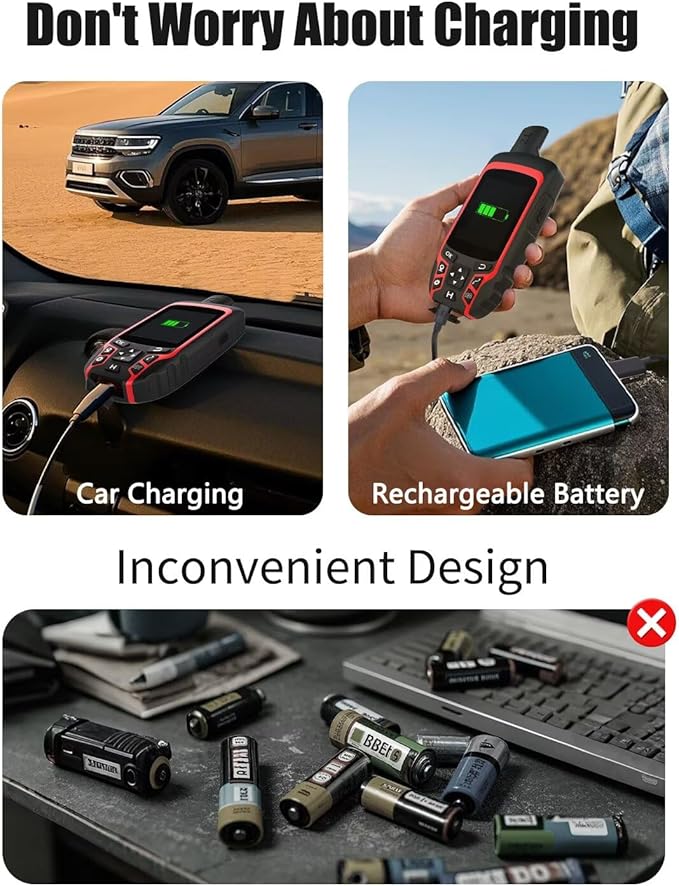
- MULTI CHARGING METHODS: Powered by internal Li-ion rechargeable battery,3500mAh battery lasts up to 20 hours use in navigation mode,support power bank, car charing, USB charging and so on.Rugged and waterproof(rated to IP65)
- WHAT YOU GET: 1x A6 Handheld GPS, 1x User Manual, 1x Charge Cable,1x Charge Adapter, 1x Hand Strap.This device don't have maps
- HOW TO USE: Please search satellite signals in an open outdoor area before using the machine. When the signal value in the upper left corner of the machine screen is below 1 m, start using to ensure the accuracy of the machine
Overview
- Brand : NiesahYan
- Model Name : A6
- Screen Size : 2.4 Inches
- Special Feature : 4 Satellites support, Long battery life, Sunlight-readable color display, Track navigation and position navigation, Waterproof Rugged 4 Satellites support, Long battery life, Sunlight-readable color display, Track navigation and position navigation, Waterproof Rugged
- Connectivity Technology : USB
- Map Type : Satellite
- Included Components : Plug, Suspension cord, USB cable, User manual
- Battery Life : 20 Hours
- Product Dimensions : 6.1"L x 0.9"W x 2.1"H
- Memory Storage Capacity : 64 MB
Share